
York Neighbors by Parcel
York's public route for a close block begins with parcel geography, not a person roster. The York County Property Viewer connects a property address, an owner association, parcel ID, sale and deed information, tax and assessment fields, and a mailing-address component. The York County Recorder can then confirm a defined recorded-ownership question. York City departments and neighborhood associations supply different kinds of context. Your immediate neighbors may be represented by adjacent parcels, but a parcel owner, an owner mailing address, and a current occupant remain separate facts.
| Source | What It Shows About a Block | Access |
|---|---|---|
| York County Property Viewer | Parcel polygons plus property-card fields for each selected parcel | Address, owner, or 18-digit PIDN search; display-only boundary disclaimer. |
| York County Recorder of Deeds / UPI | Recorded ownership sequence, deed reference, and legal description | Party or property search, County systems, and counter access by era. |
| York City neighborhood associations | Community-area geography and a City coordination layer | York City page and linked material; no member directory was verified. |
| Election record process | Limited statutory election-list categories | Qualified request process with use restrictions, not a block directory. |
| York City BPI and Planning | Defined project or code-record request by property and date | Application route or office request; no public history index was verified. |
This division keeps the research honest. York County Assessment and GIS data can identify a parcel-level owner association. They cannot establish every person who lives there, and a correspondence address should not be relabeled as someone’s present location.
York Buffer Parcel Blocks
The York County Property Viewer has a precise Buffer Parcel tool, so a close-block search does not need a manual map estimate. Search the focal property by address, owner, or Parcel ID Number, select the correct card, then use Buffer Parcel with the parcel ID and a linear-unit distance. The tool displays a one-mile default and returns a parcel-polygon result layer. Reduce the distance to a practical block before reading the returned cards one at a time.
York County Buffer Parcel service is the official geoprocessing endpoint documented for this map method.
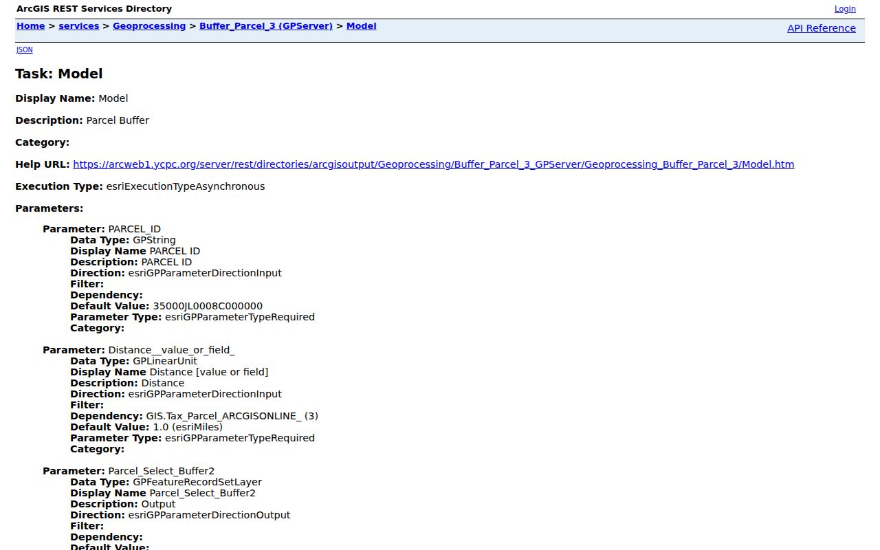
The returned polygons are a research boundary, not a survey line and not a list of residents. Open the surrounding property cards individually and record only the public parcel attributes relevant to the address question.
Map York Neighbors Around a Parcel
Select by Location offers a second, narrow-block route in the York County Property Viewer. It requires the Parcel ID and offers an optional search distance, with a 1,000-foot default. Like Buffer Parcel, it returns selected parcel or lease layers rather than a personal directory. Set a constrained distance, inspect the results, and preserve the PIDN with each property card so the map selection can be checked again later.
- Find the focal address in the York County Property Viewer and confirm the property address on the returned card.
- Record the 18-digit PIDN, previous-owner field, sale or deed reference, and public assessment details that appear there.
- Run Select by Location or Buffer Parcel with a limited feet-distance appropriate to the immediate block.
- Open each selected card, then use the York County Recorder only when a defined ownership question needs the recorded instrument.
That flow identifies nearby parcels instead of producing a list of neighbors. A whole named street calls for a broader address chain, available through the York streets directory.
York Property Cards Around a Block
York's Property Viewer uses three public optional search modes: Property Address, Owner Information, and PARCEL ID NUMBER (18-Digit). Its property cards can show a property address, owner, mailing-address component, previous owner, Parcel ID, sale or deed data, tax and assessment information, and classification details. York County guidance says parcel boundaries are displayed for reference rather than survey accuracy. Tax data updates twice each year after millage approval, and other assessment data is captured about monthly.
The distinction between fields matters. The property address is the situs address, the physical identifier for the parcel. A mailing address is correspondence data and may be elsewhere. The legal description and UPI identify the recorded tract. None of those fields proves who your neighbors are on a given day. Homestead, Farmstead, and Clean and Green entries are assessment-program fields, not a household roll.
For a boundary question, York County Assessment lists 717-771-9232. Tax-map questions go to taxmap@yorkcountypa.gov, and application questions go to the York County Planning Commission at 717-771-9870. Those channels are better than guessing from a map display.
York Community Association Areas
York City treats neighborhood associations as a community-contact layer. The current York City page says Police Crime Prevention Services works with the associations and gives a total of 17. The York City-linked material names areas including Historic Newton Square, The Avenues, Dever's Area, Downtown East, Northeast, Northwest, Olde Towne East, Salem Square, Springdale, Veterans Memorial Park, West Bank, WeCo, Pershing and King, Yorktowne, Princess and Pine, and Doctors Row.
| City resource | What it provides | Current-use caution |
|---|---|---|
| Neighborhood Association page | York City coordination point and association geography | Use the current York City page to confirm the active contact. |
| Association map or legacy list | Named areas such as The Avenues, Downtown East, and West Bank | Older entries include inactive or not-actively-meeting notes. |
| York City map catalogue | Neighborhood, ward, annexation, zoning, and historic-district maps | Check the map date and its City jurisdiction. |
York City's neighborhood association page is the source for the City coordination layer.
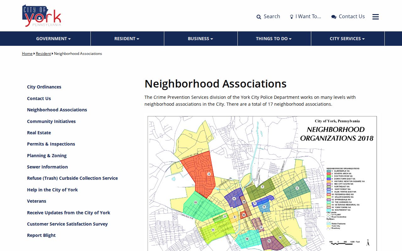
The count and older status notes do not fully align. Confirm an association through the City before relying on it as an active area contact, and do not treat the list as a member directory.
York Election Requests Near a Block
Pennsylvania's public voter-status service confirms registration status and polling information. It is not an open street browser, and its exact live form fields were not verified during the research. York County's Elections and Voter Registration office handles applications, updates, and ballots, but says it cannot furnish reports, street lists, or walking lists. Those record requests have a separate process through the elections-report location.
York's revised February 16, 2026 Voter Lists form permits certain local-area requests in person or by mail, while a whole-county listing comes through the Department of State. The form requires identity, the precise list sought, election districts selected by Municipality, Ward, and District, delivery method, a declaration, and payment details. Its companion public-records form covers inspection or copies for qualified York electors during business hours. Election Code rules restrict use to election, political, or law-enforcement purposes and prohibit internet publication outside the stated rules.
Never call voter data a neighbor list. The lawful request channels are limited, the list categories differ, and protected or substitute addresses remain subject to the applicable law.
York Project Records by Address
The York City Bureau of Permits and Inspections is an address-focused channel for property-maintenance, construction-code, and health and sanitation work. Most applications use OpenGov. York City Planning and Zoning likewise routes zoning permits, site plans, subdivisions, stormwater plans, and zoning determinations through OpenGov. These records may explain a project relationship to a property, but they do not identify an entire household.
No public historical permit or violation result interface was verified. The documented fallback is a focused request naming the property, date range, record type, and desired medium, or the York City BPI appointment route and two York City kiosks. York's City map catalogue can add the relevant City geography, provided its production date is checked.
York Official and Commercial Lookup Routes
Official parcel and deed systems identify the custodian, the record type, and the limits on what a field means. A commercial neighbor-lookup category may combine public and other data, but it does not replace the York County Property Viewer, York County Assessment data, York County Recorder record, or a York City source. When a name, property, or mailing detail conflicts, return to the original custodian rather than treating a combined result as proof.
| Route | Best use | Limit |
|---|---|---|
| Official parcel and assessment records | Parcel identity, owner association, map, values, and public property fields | Owner, mailing address, and current occupant are different facts. |
| Recorder and UPI records | Recorded instruments, legal descriptions, and ownership sequence | Access route depends on the instrument era and does not prove occupancy. |
| Commercial lookup category | A possible lead to verify with the custodian | Coverage, accuracy, and currency can vary; it is not an official record. |
York's UPI connects a physical address to the legal record trail. Keeping the UPI, lot or block reference, and book/page with the address is more reliable than combining unrelated names from separate sources.
York Neighbor Lookup Privacy
Public access has real limits. Pennsylvania's Address Confidentiality Program can supply a substitute address for participants in voter registration, court and state records, marriage licenses, and other listed systems. A substitute address is part of a safety plan and is not an error to uncover. DMV information is outside the Right-to-Know Law and is governed by Pennsylvania vehicle law and the federal Driver's Privacy Protection Act. Utility account data, protected vital records, sealed court material, protected minor information, and certain abuse-victim information are not a path to fill gaps in a property record.
York Recorder guidance also warns against copying personally identifying banking, loan, or Social Security data that appears in a document. If a public image seems to expose sensitive data, report the issue to the custodian rather than saving or circulating it. The Pennsylvania Right-to-Know Law yields when another statute, privilege, court order, or exemption controls access.
Lawful use. Use York block records for personal, family-history, estate, property-curiosity, or civic-transparency purposes. Stalking and harassment are crimes under 18 Pa.C.S. §§ 2709.1 and 2709.